In this, the second of a series of essays, the technologies, tools and resources available to today’s water system engineers and regional planners are examined. In the last essay, it was noted that near-term enhancements and repairs critical to preserving existing water infrastructure; additionally there are many new opportunities as populations migrate and the developing nations of the world continue to grow.
One of the most positive developments in the drive to provide sustainable water supplies around the globe are the technological resources that are now available to planners. Geological maps, ground penetrating radar and satellite imagery take a great deal of the historic ‘educated-speculation’ about where and how to obtain fresh water. Additionally, such tools allow for regional water use disputes to be resolved based on facts. Consider, for example the case of St. Martin v. Mobil Exploration & Producing US Inc., Plaintiffs introduced aerial photographs to show open ponds produced by the oil companies were eroding a marsh, presenting a series of photographs that showed the progression of the deterioration of the marsh. These aerial photos, combined with testimony from an expert witness interpreting the photographs, and testimony from the plaintiffs and others familiar with the land, led the court to conclude that defendants caused the degradation to the land.
In a separate case, Oklahoma Water Resources Board v. Texas County Irrigation and Water Resources Association, a case involving groundwater elimination. The Oklahoma Supreme Court reversed the lower courts decision to grant an oil company a permit to withdraw groundwater for an oil recovery process. In reversing the decision the court noted the problem of groundwater being drained faster than it is being replaced. The court also noted that Texas had the same problem and they had developed a technique using satellite imagery to get precise estimates of the depletion of the water table. By using the satellite data, the Texas planners could properly determine if the drain-off would result in a local water supply issue. In relation, Oklahoma had done nothing to try and remedy the problem and until such definitive techniques were used, the impact of the drain-off would be unknown.
When remote imagery, such as images taken via satellite, is used in conjunction with geological data or ground radar, it is generally referred to as geospatial surveying. The case study of Wadi Dalal is a dramatic example of the impact geospatial technologies can have on humanitarian relief operations. When refugees were fleeing Sudan, the United Nations Human Rights Commission (UNHCR) needed to quickly fix the locations of the refugee camps. Complicating matters, the region is arid and access to sustainable clean water for large numbers of people was required. After analyzing radar and visual satellite imagery, the UNHCR established the Gaga refugee camp along the Wadi Dalal in early 2005 and began resettlement of thousands of refugees soon thereafter. After drilling wells, the proven water reserves at the site have been confirmed capable of supporting up to 30,000 refugees.
Additional technology tools that make the job more manageable are computer aided design and accurate maps. One tool that is often overlooked outside of the planning community, however, is accurate census figures. A current census coupled with historic figures can show population migration trends and serve as a basis for predicting future water supply and water treatment needs for a region. Such predictions are required as water infrastructure is often in place for 50-100 years (or longer). Essentially, the future capacity of supply pipes and the treatment capacity of wastewater recovery facilities much be planned and built into today’s infrastructure to deal with tomorrow’s predicted demand.
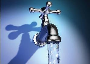
The most critical resource, though, is often the most scarce – funding. Through the years, many solutions have been put into practice; fee-for-use, national or regional tax supports, bonds, to name some of the most well known. Fee-based services are often effective in maintaining and repairing facilities, but the initial cost of development is quite high. Complicating matters is that in a region that is only recently being developed, the local population may not be able to support the initial construction due to either small population size, local poverty or both. Starting in the 1950’s, the United States approached this issue from the national level, investing billions of dollars into building critical water and wastewater treatment facilities. In 1987 the policy shifted to one of providing grants and capitalized loans to the states; allowing for much more of a regional approach to prevail. Even with this funding, however, the US EPA has projected that the funding shortfall over the next 20 years will be $277 billion for drinking water infrastructure and $181 billion for wastewater infrastructure.
Looking toward the future, it will be critical to support sustainable water development by identifying sustainable funding vehicles. One option for the United States is financing through Private Activity Bonds (PABs). PABs are issued to finance various types of facilities owned or used by private entities, and in the United States, water infrastructure is often a combination of both public and private facilities plus piping networks. An alternate approach is one endorsed by the American Society of Civil Engineers (ASCE). The ASCE advocates the creation of a national Water Infrastructure Trust Fund to finance the national shortfall in funding drinking water and wastewater infrastructure systems and other projects designed to improve the nation’s water quality. That said, the ASCE still supports a variety of other financial mechanisms to support development, such as bonds, tax-exempt financing at state and local levels, public-private partnerships, state infrastructure banks, user fees, and broad-based environmental restoration taxes to address problems associated with water pollution and wastewater management and treatment.
Whatever the solution, having as many options available as possible is always helpful in solving the problem. H2bid.com is one way of discovering those options that may be currently out of sight, but are actually just over the horizon.